Mapping the Atlantic Offshore Wind Buildout
Since 2012 the Bureau of Ocean Energy Management has parceled roughly two million acres of the Atlantic Outer Continental Shelf into some thirty wind-energy lease areas from Massachusetts to North Carolina, held by the developers building the country's first generation of offshore wind. The leases sit in crowded water, threaded between shipping lanes, fishing grounds, marine protected areas, and one another's export-cable corridors.
The buildout is reported one project at a time, which obscures its structure: where leasing concentrates, what each area must negotiate, and which companies hold the acreage.
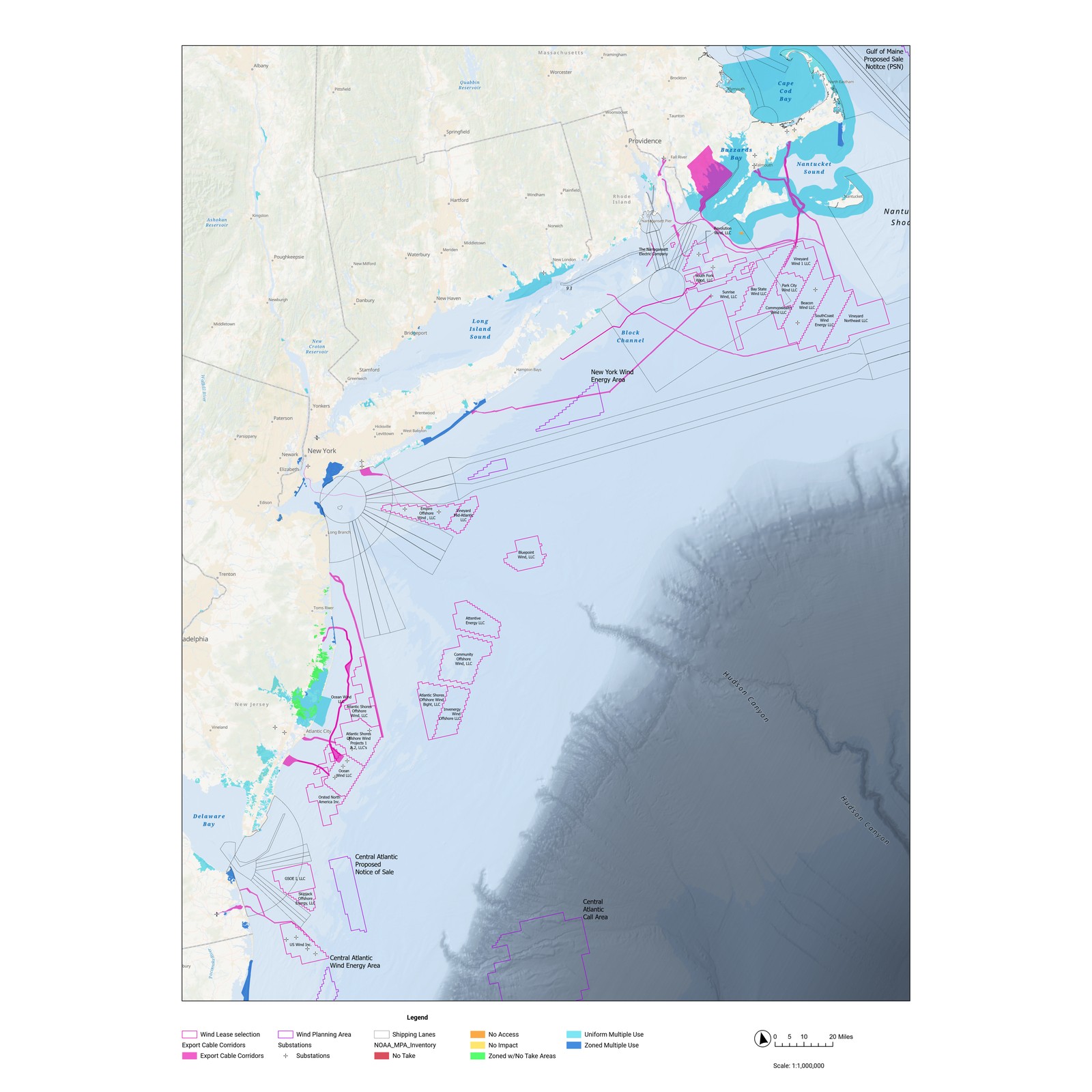
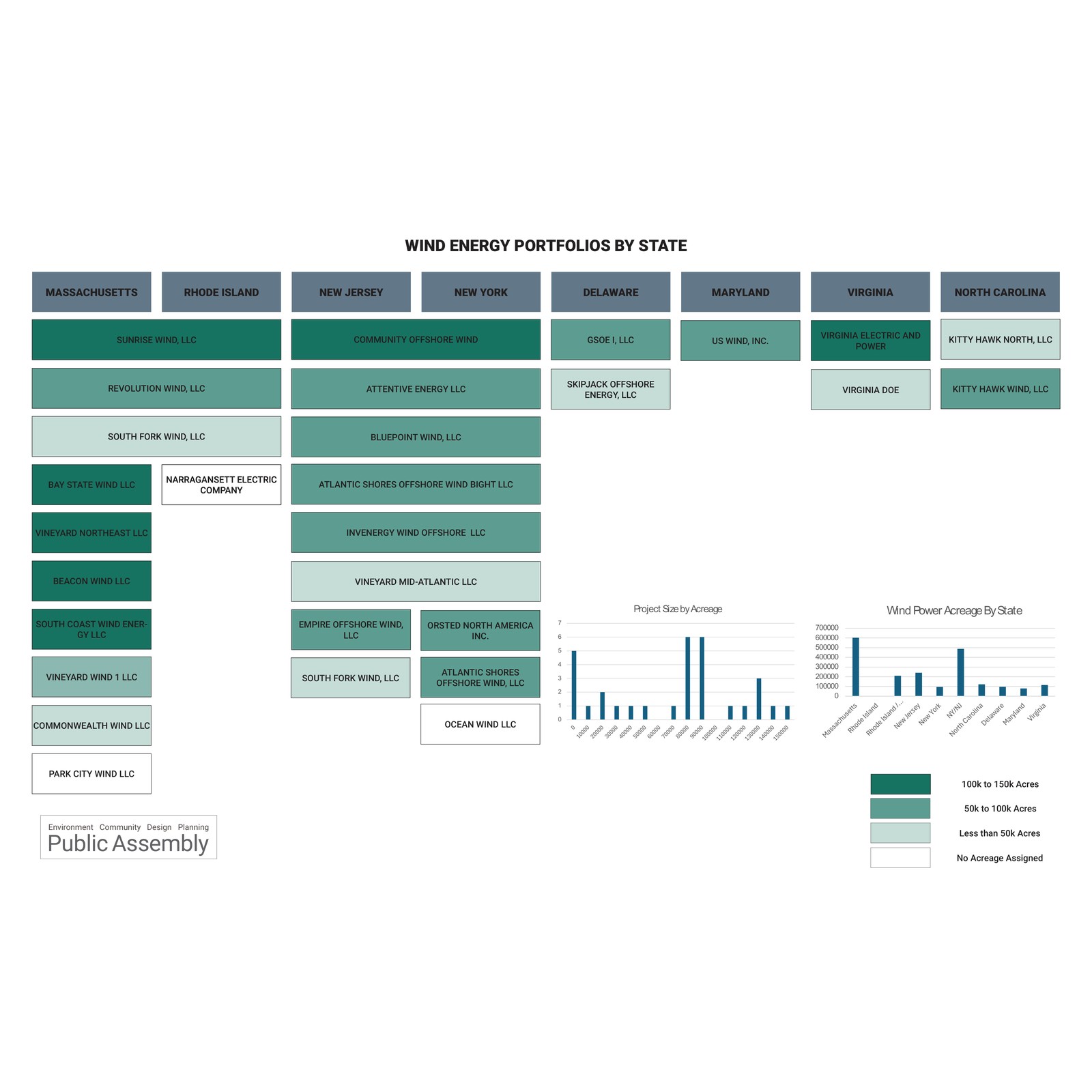
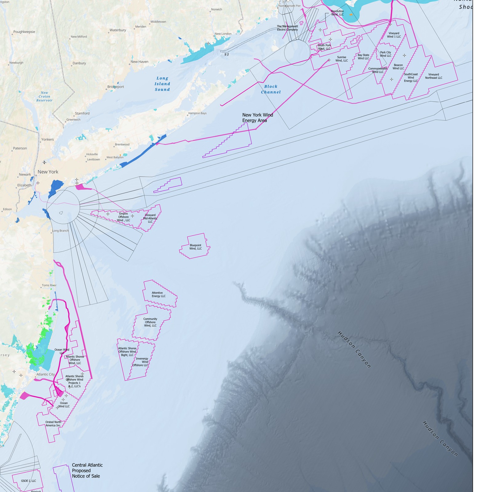
Two views of the same system, built from public federal data. A single map assembles every Atlantic lease area, wind energy area, and call area against the marine constraints they cross — shipping lanes, protected areas, cable corridors, and bathymetry — from the Gulf of Maine to the Central Atlantic. A companion diagram reorganizes the same leases by the entity that holds them, arranged by state and scaled by acreage, so ownership can be read as directly as geography.
- Roughly two million acres are under lease across about thirty areas and eight Atlantic states, from Massachusetts to North Carolina.
- Leasing concentrates in three zones — southern New England, the New York Bight, and the New Jersey–Delaware–Maryland shelf — while the Gulf of Maine and Central Atlantic remain at the call and planning stage.
- Massachusetts holds the largest leased acreage of any state; New York and New Jersey follow.
- Most areas are held by single-purpose LLCs, and lease boundaries repeatedly abut shipping lanes and protected areas — making cable routing and multiple-use conflict a siting problem before an engineering one.
National targets say nothing about where offshore wind can actually be built. That is decided lease by lease, in crowded water, by the companies holding the acreage. One frame containing both the geography and the ownership makes the buildout legible as a whole — its concentrations, its recurring conflicts, its owners.