Mapping the Economics of Farmland Dry-Up
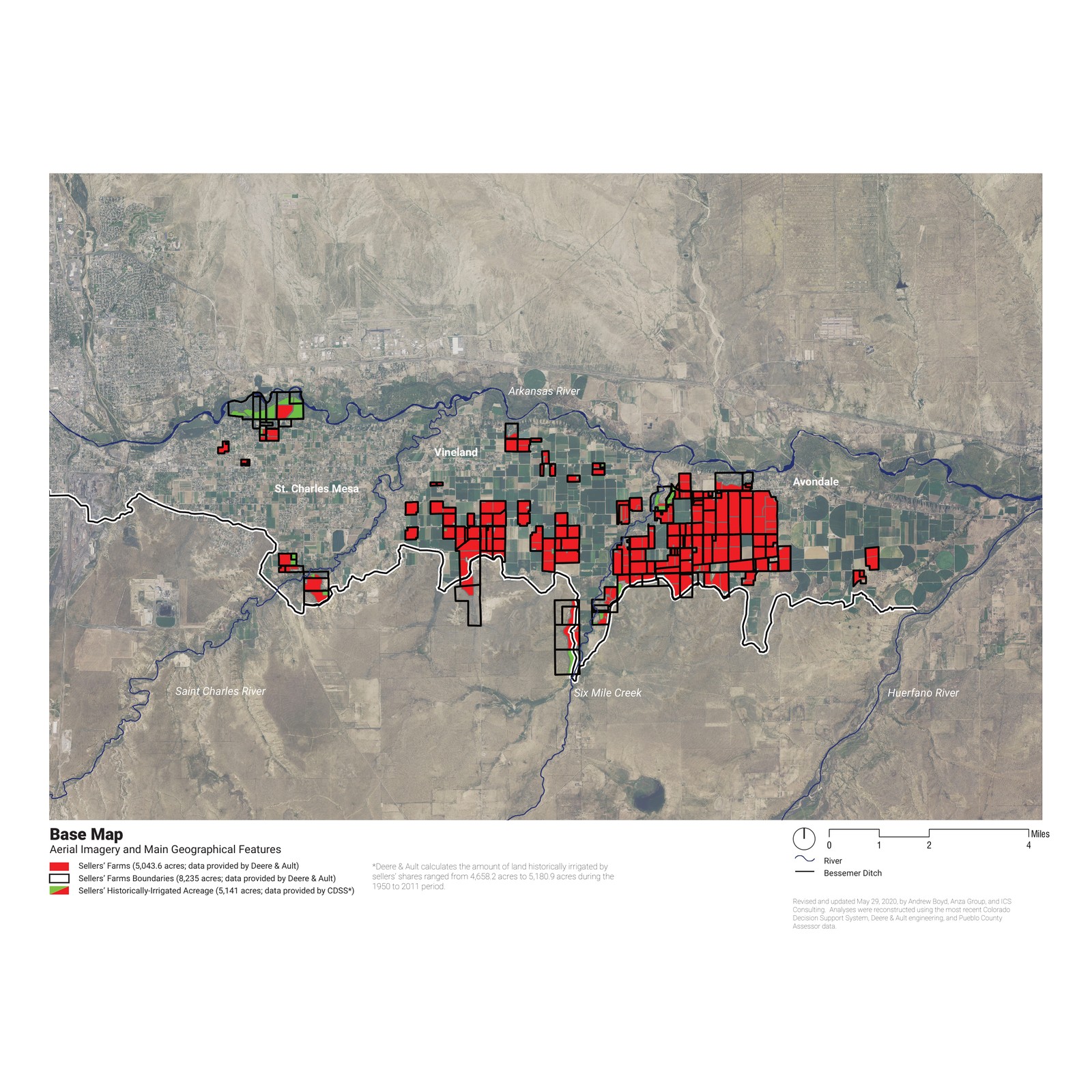
In 2009 and 2010 the Board of Water Works of Pueblo bought 5,540 shares in the Bessemer Irrigating Ditch Company from Pueblo County farmers — a third of the ditch's irrigated farmland, about 5,141 acres across the St. Charles Mesa, Vineland, and Avondale communities. The water will serve the growing city; the land it leaves will dry up. Bessemer-irrigated land is 2% of Pueblo County's farm acreage but generates roughly 40% of its agricultural output, so where and how that dry-up happens carries consequences well beyond the parcels that lose their water.
Pueblo County's 1041 regulations bar water projects from degrading any current or foreseeable-future sector of the local economy, agriculture included. Meeting that standard meant quantifying what dry-up costs and testing whether a smarter pattern of dry-up could hold the loss — a question that is economic and spatial at once.
The study paired an economic impact analysis with a spatial model of the ditch, testing dry-up as a set of scenarios rather than a single outcome. The spatial analytics, mapping, and GIS were prepared through Innovative Conservation Solutions.
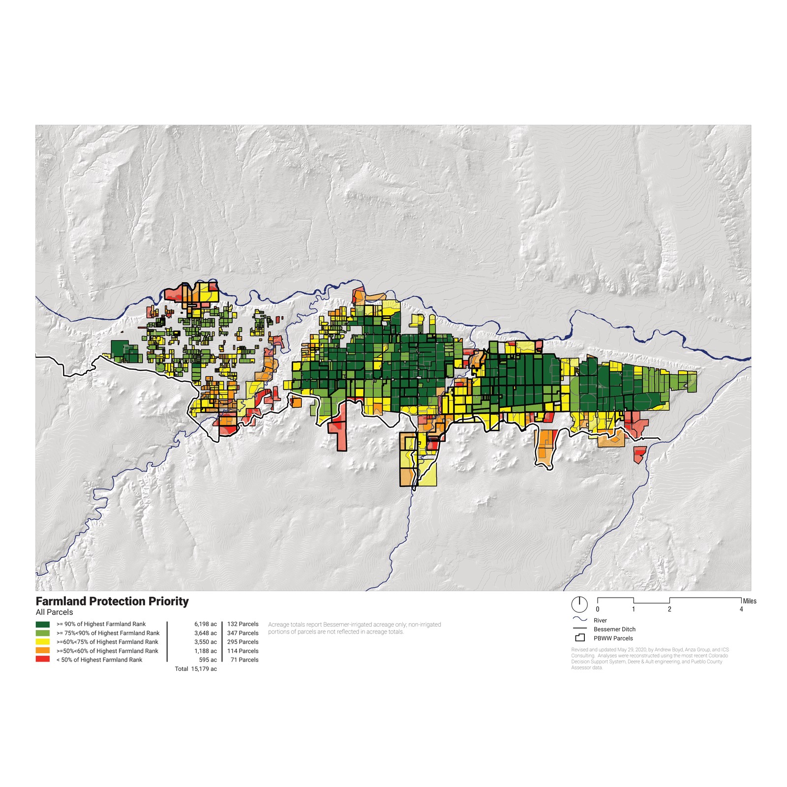
- Productivity — a Farmland Protection Priority index ranking every parcel on soils, cropping history, and yield, isolating the ditch's most productive ground.
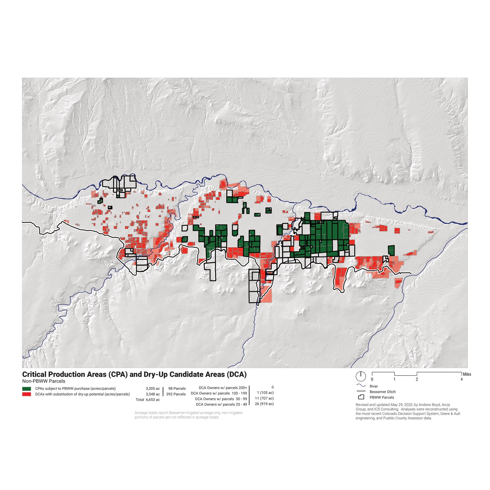
- Critical vs. candidate areas — Critical Production Areas worth keeping in production set against Dry-Up Candidate Areas, where retiring water does least economic harm and most environmental good.
- Scenarios — current, foreseeable-future, and anticipated dry-up, against alternatives that substitute, continue, or rotate farming at 500 to 3,000 acres.
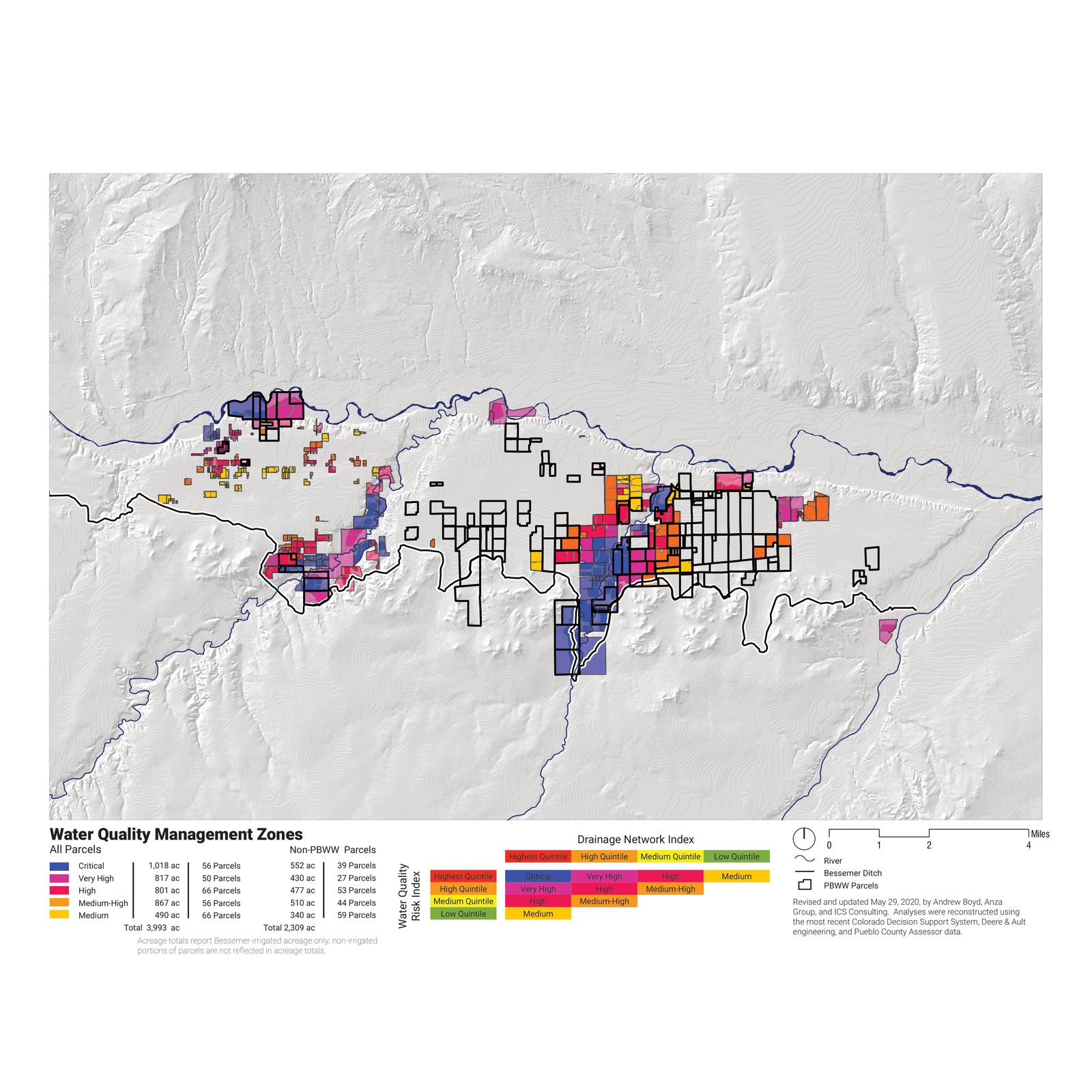
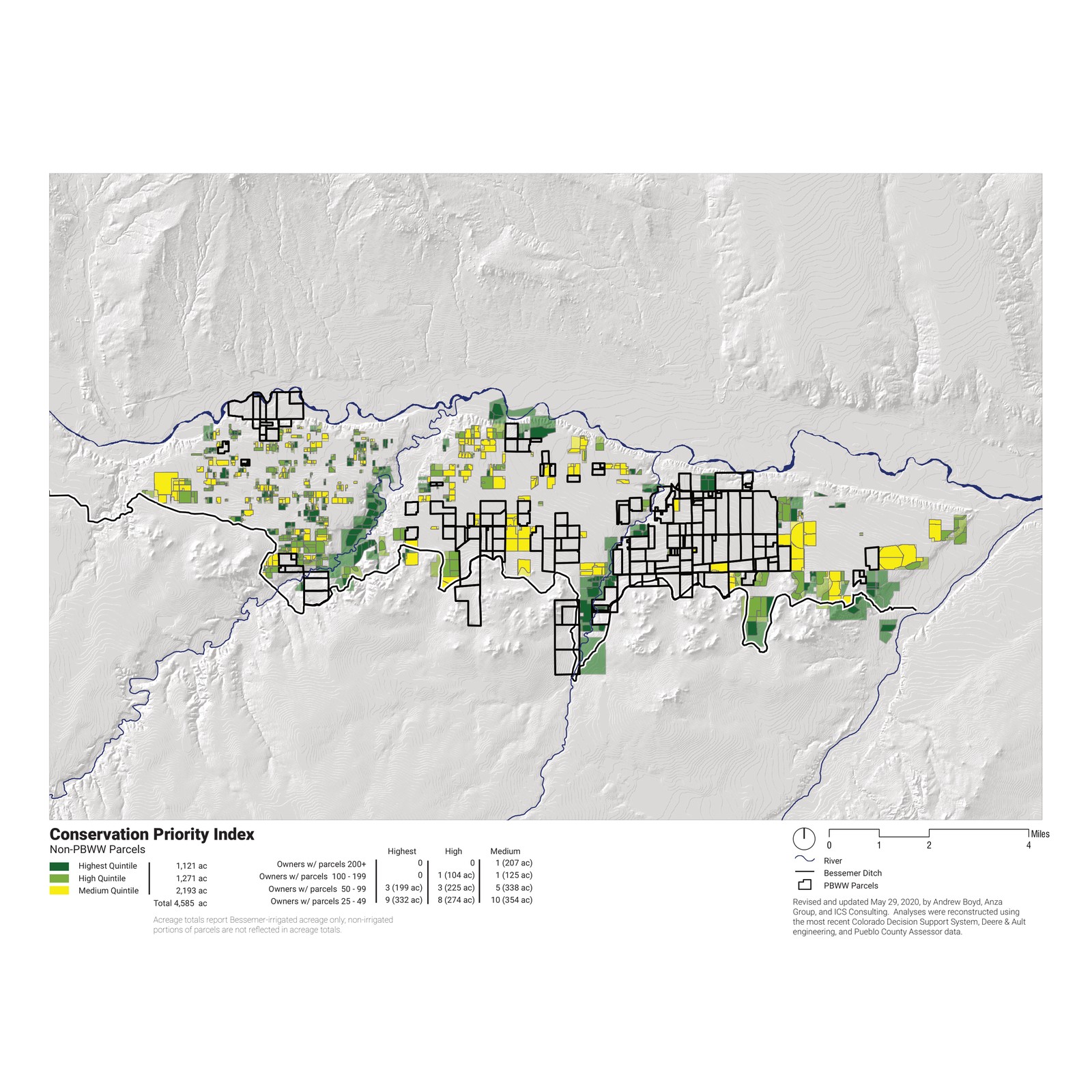
- Co-benefits — water-quality management zones and conservation priority, locating where strategic dry-up improves return flows and habitat.
- Current Bessemer production generates about $29.1 million a year in county economic activity and some 530 full-time-equivalent jobs.
- Left unmitigated, drying up the 5,141 acres costs Pueblo County an estimated $8.4 to $17 million a year.
- Substituting dry-up onto less productive land — retiring water from 1,500 candidate acres while keeping the best ground irrigated — lifts output about $2 million above current levels, to $31.1 million, even with the full 5,141 acres dried.
- A 1,000-acre continuing-farming alternative, modeled on Aurora's Rocky Ford program, holds output near $29.7 million a year.
- The analysis supported a “substitution of dry-up” provision written into Pueblo Water's water-court decree, enabling voluntary, market-based swaps of which land is dried.
The economic consequences of a water sale are set by geography: which fields go dry decides how much production, employment, and habitat a county keeps. Modeling productivity, dry-up candidates, and water quality together turned that question into a set of specific acres, and gave Pueblo Water and its farmers a mitigation path a water court could adopt.
The study was commissioned and published by Palmer Land Conservancy: Bessemer Farmland Conservation Project.