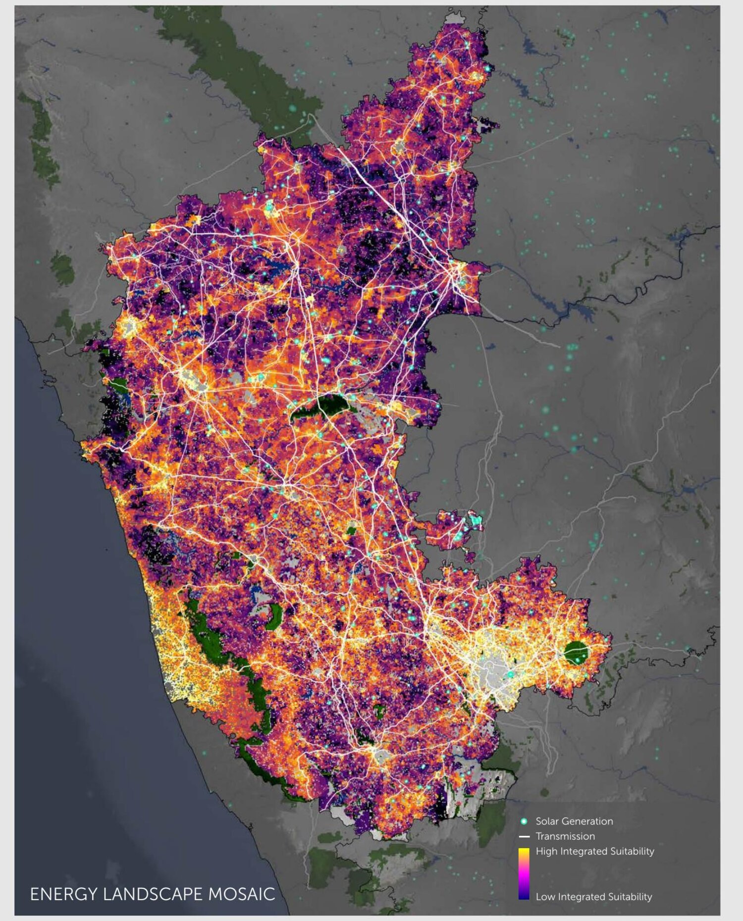
Integrating the Energy Landscape Mosaic
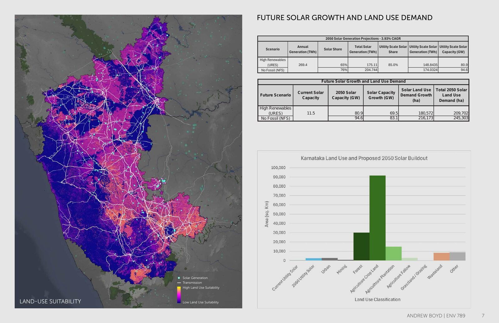
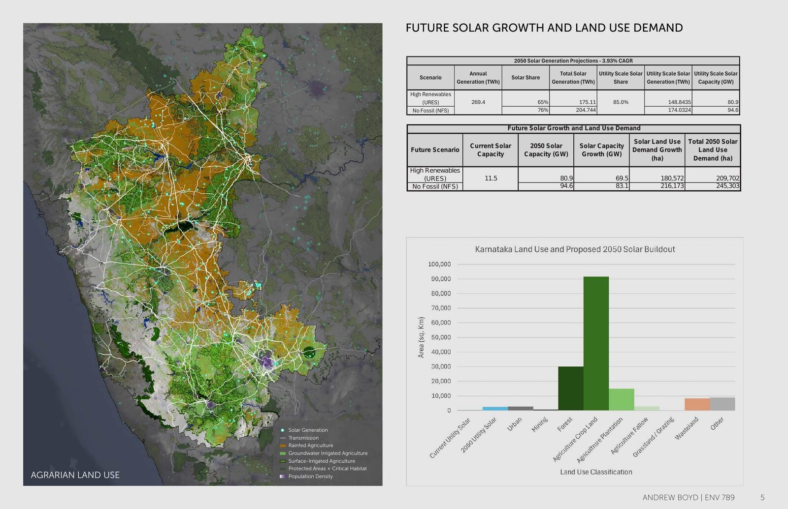
Karnataka must roughly double utility-scale solar by 2050 — an estimated 80–95 GW, requiring on the order of 210,000–245,000 hectares of land. That expansion competes with agriculture, sensitive ecosystems, and rural livelihoods routinely overlooked when siting utility-scale solar. The analysis identifies where solar can go with the least land-use and social conflict.
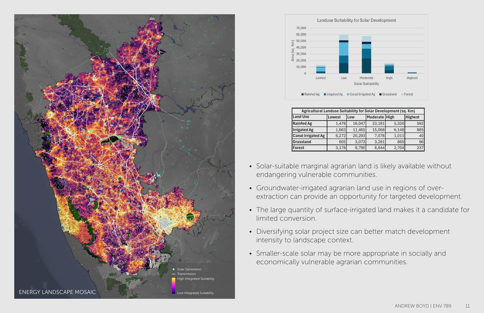
A GIS-based spatial multicriteria suitability model combining two equally weighted surfaces:
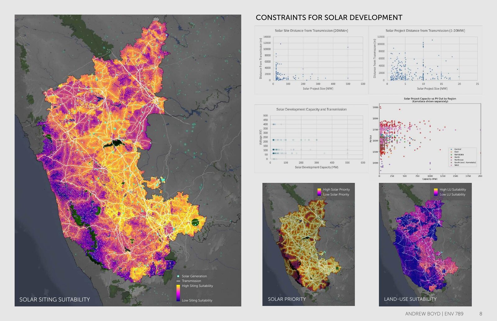
- Land-use suitability — solar siting (transmission proximity, PVOUT solar resource, slope), environmental exclusions, and agricultural logic that avoids irrigated cropland while prioritizing rainfed and over-extracted-groundwater areas where solar can ease aquifer stress.
- Socio-economic vulnerability — livelihood sensitivity and social vulnerability (SC/ST share, illiteracy, households without electricity, sanitation, or assets).
The model integrated 10+ national and global datasets.
- Sufficient solar-suitable marginal agrarian land is available without displacing the most vulnerable communities.
- Over-extracted groundwater-irrigated land is a targeted opportunity — conversion can relieve aquifer stress.
- Existing solar clusters within ~2 km of transmission, confirming grid access as the dominant siting driver.
- Matching project scale to landscape context materially lowers conflict.
Land, not capital or technology, is the bottleneck in Karnataka's solar expansion, and the costs of getting siting wrong fall on the communities least equipped to absorb them. Because the framework runs on reproducible, national-coverage data, it transfers across regions as a fast first-pass siting screen.