Mapping the Southwest's Energy Transition
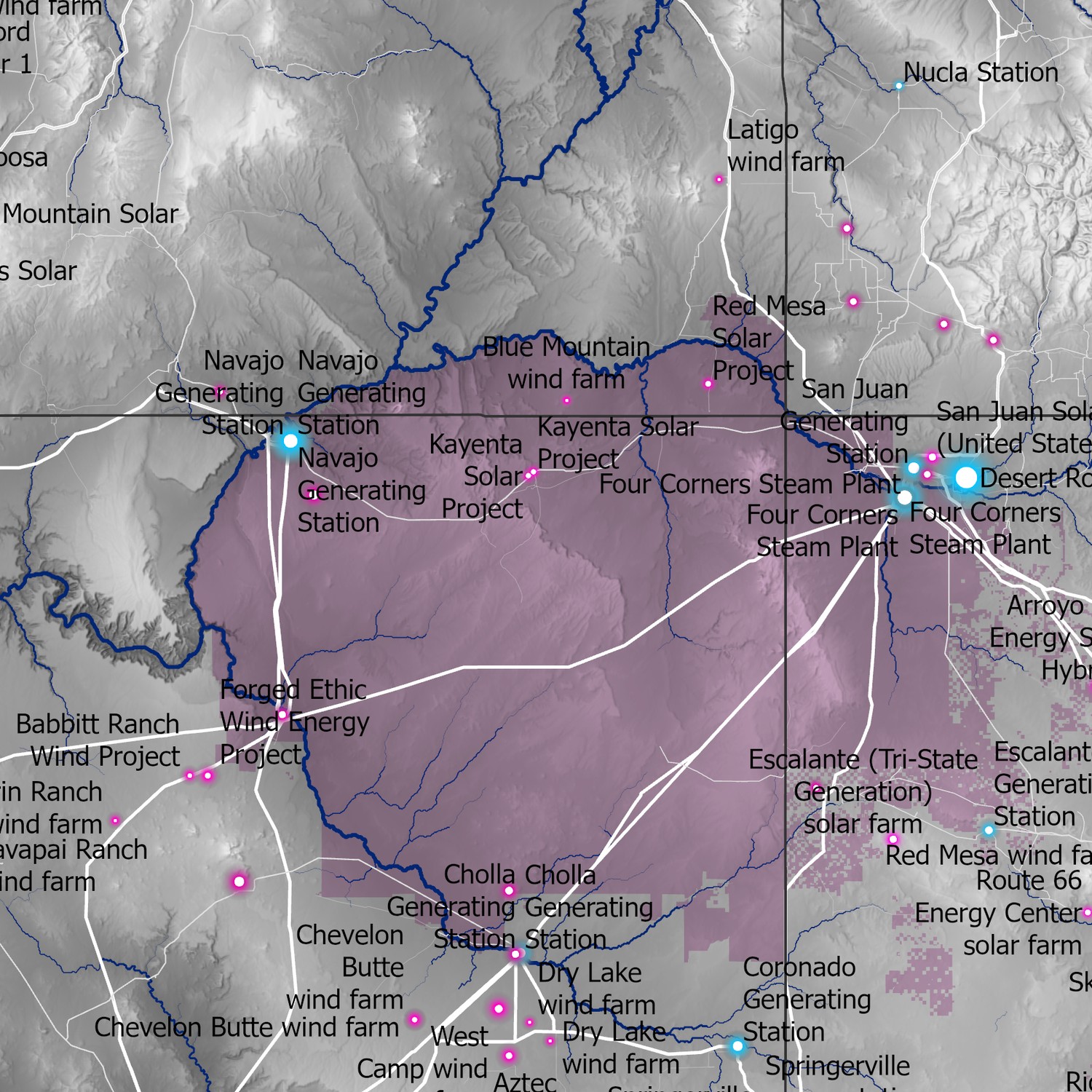
Coal plants that anchored the Four Corners economy for half a century — San Juan, Navajo Generating Station, Four Corners — are retiring, and the solar, wind, and transmission replacing them are being built on the same ground: Navajo and Hopi lands, federal holdings, and the mines and plants of the outgoing coal economy.
A transition of this kind is more than a swap of generating capacity. It reorganizes land, water, and revenue: who holds the leases, where the transmission runs, which communities keep the jobs. Those decisions are spatial, and they determine who benefits from the buildout and who absorbs its costs.
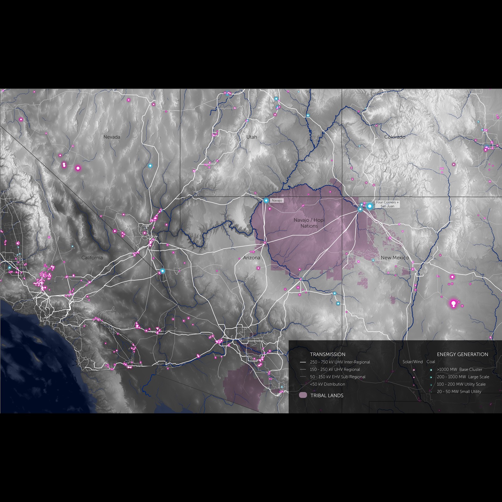
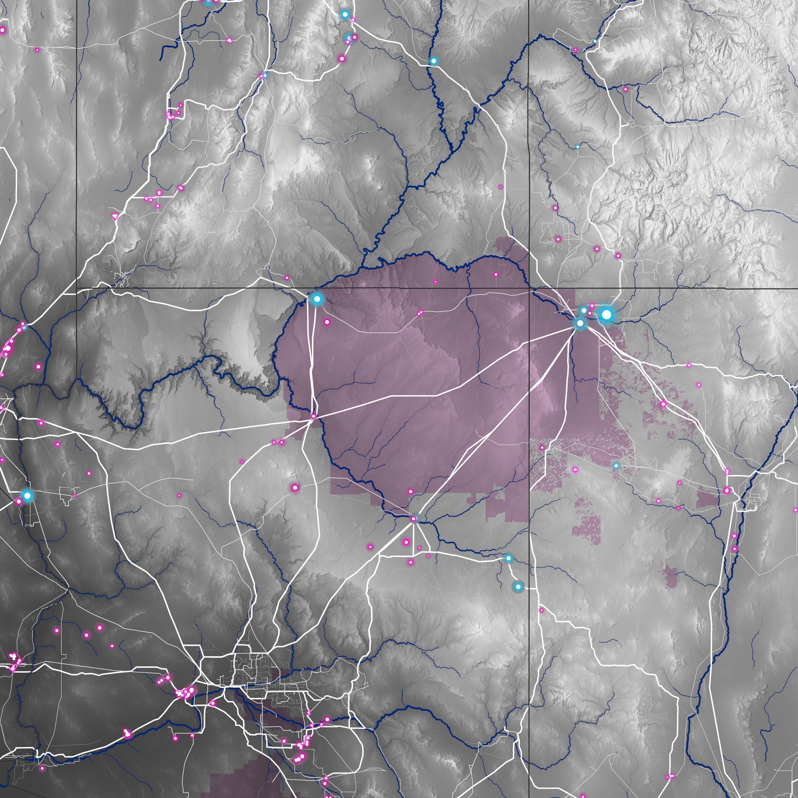
The work begins with a single map of the Southwest's energy system: generation by source and scale, the transmission that connects it, and the tribal and federal lands it crosses, over the terrain that shapes all three. Built from Global Energy Monitor's plant-by-plant trackers and public land and transmission data, it puts coal retirement and renewable buildout in one frame — the physical starting point for a larger question about the incentives, markets, and governance arrangements that will decide how the transition lands.
- Renewable generation and new transmission cluster around the retiring coal complexes and the high-voltage corridors already built to serve them — the grid's sunk infrastructure is steering where the new economy goes.
- Much of the strongest solar and wind resource sits on or beside tribal land, making land tenure and Indigenous governance central to the buildout rather than incidental to it.
- The corridors that once carried coal-fired power now carry — or soon will carry — renewable power, concentrating both the opportunity and the disruption of the transition in a few places.
The megawatts are the easy part of a regional transition. The harder questions are whose ground the new infrastructure occupies, which incentives route the investment, and who is left holding the liabilities of the old economy. Mapping the system whole is the first step toward designing financial and governance arrangements that are ecologically grounded and accountable to the communities living through the change.