Stewarding Farmland Through Municipal Water Transfer
In 1985 and 1986 the City of Thornton bought 112 farms across Larimer and Weld Counties — 18,751 acres — for the water rights attached to them, and in 1998 secured a decree converting those rights from agricultural to municipal use. The city will move the water south to its taps between 2025 and 2065 and does not intend to hold the land afterward, so the future of 18,000 acres of northern Colorado farmland is already on a schedule.
The Northern Properties Stewardship Plan governs that half-century transition — how the land is managed, how water is removed, and how ownership is eventually transferred. Setting its course was first a mapping problem: where the best soils and most productive farms are, where water has already been dried up and where it might remain, and which lands carry conservation value worth holding.
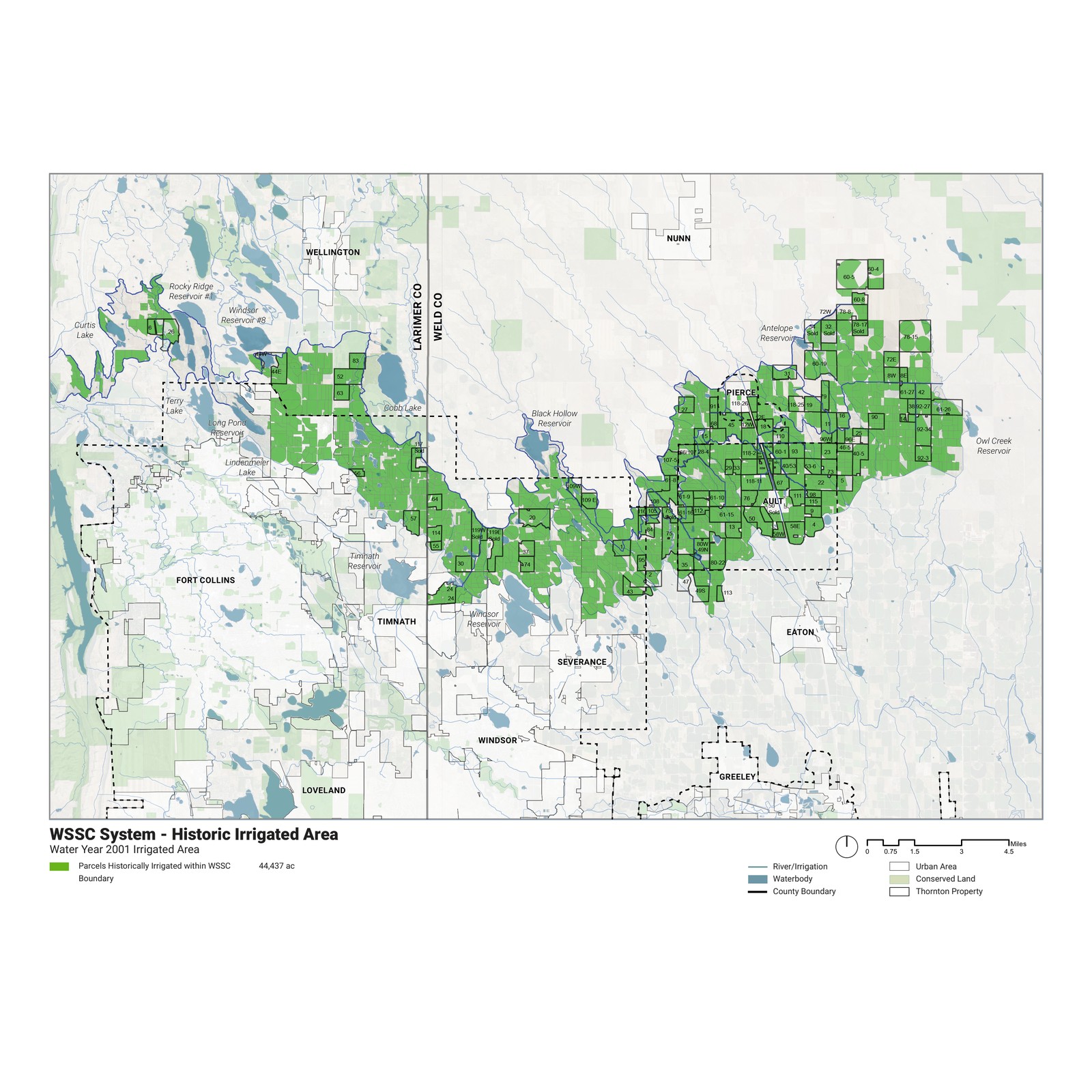
The WSSC irrigation system — the ditch network that carries Thornton's shares — was assembled into a single evidence base and read through four questions. The GIS analysis and cartography were prepared through Innovative Conservation Solutions.
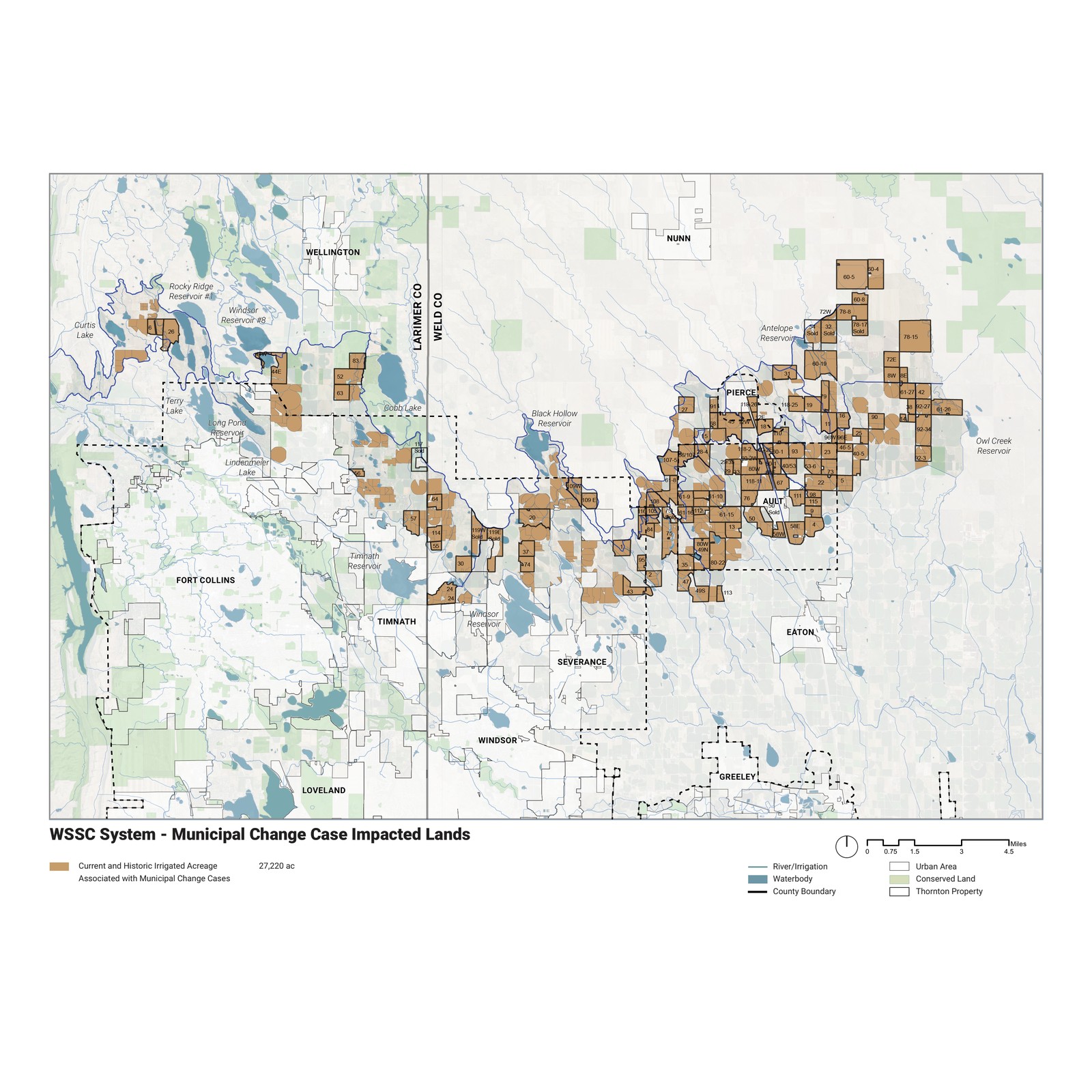
- Irrigation and dry-up — historic against current irrigated area, and the acreage that would remain under future municipal change cases; surface water has been removed from an estimated 12,700 WSSC acres since 2001, reconstructed where state Decision Support System data does not track it.
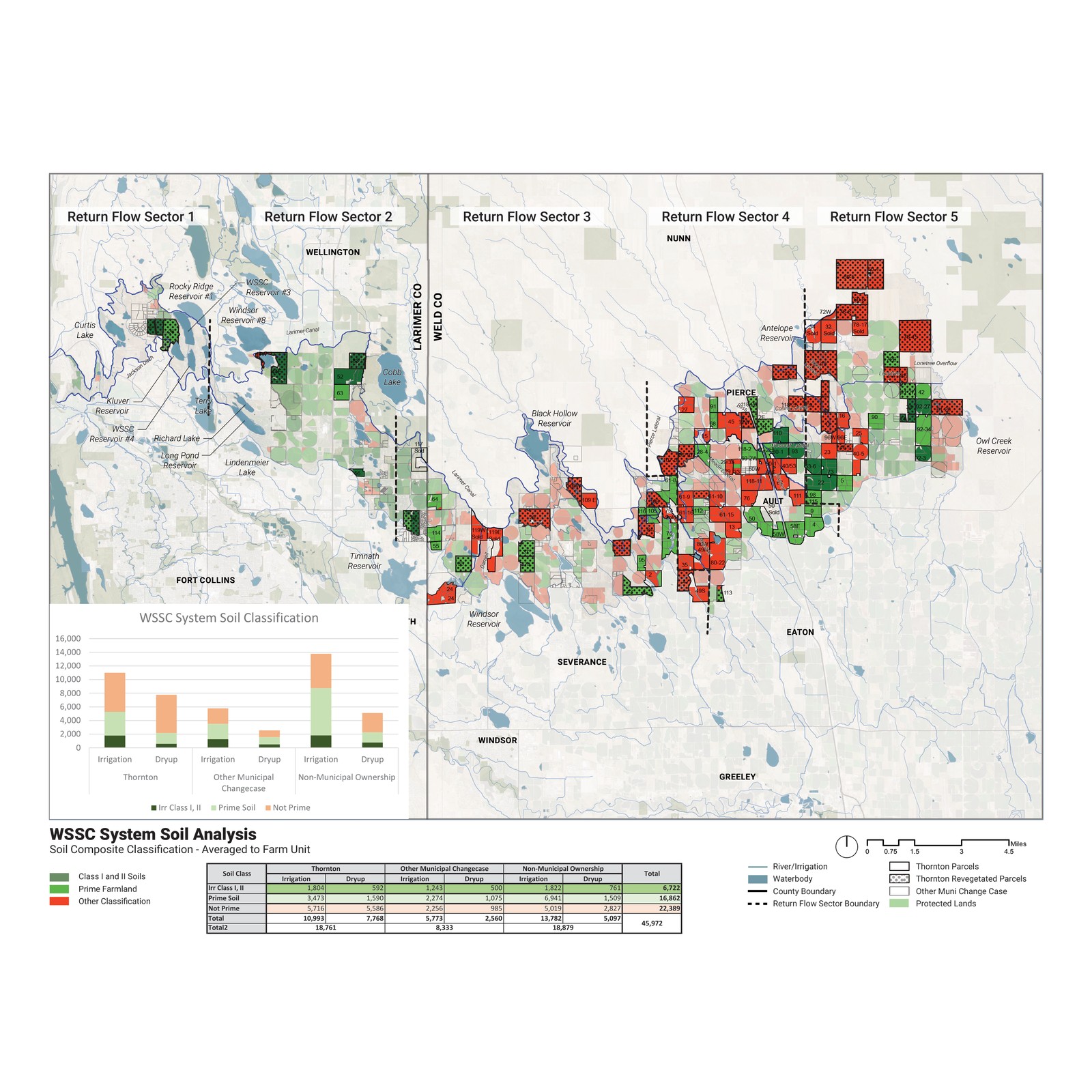
- Agriculture — USDA NRCS soil classes averaged to the farm unit, isolating Prime Farmland and the Class 1 and 2 soils that carry the fewest production limits.
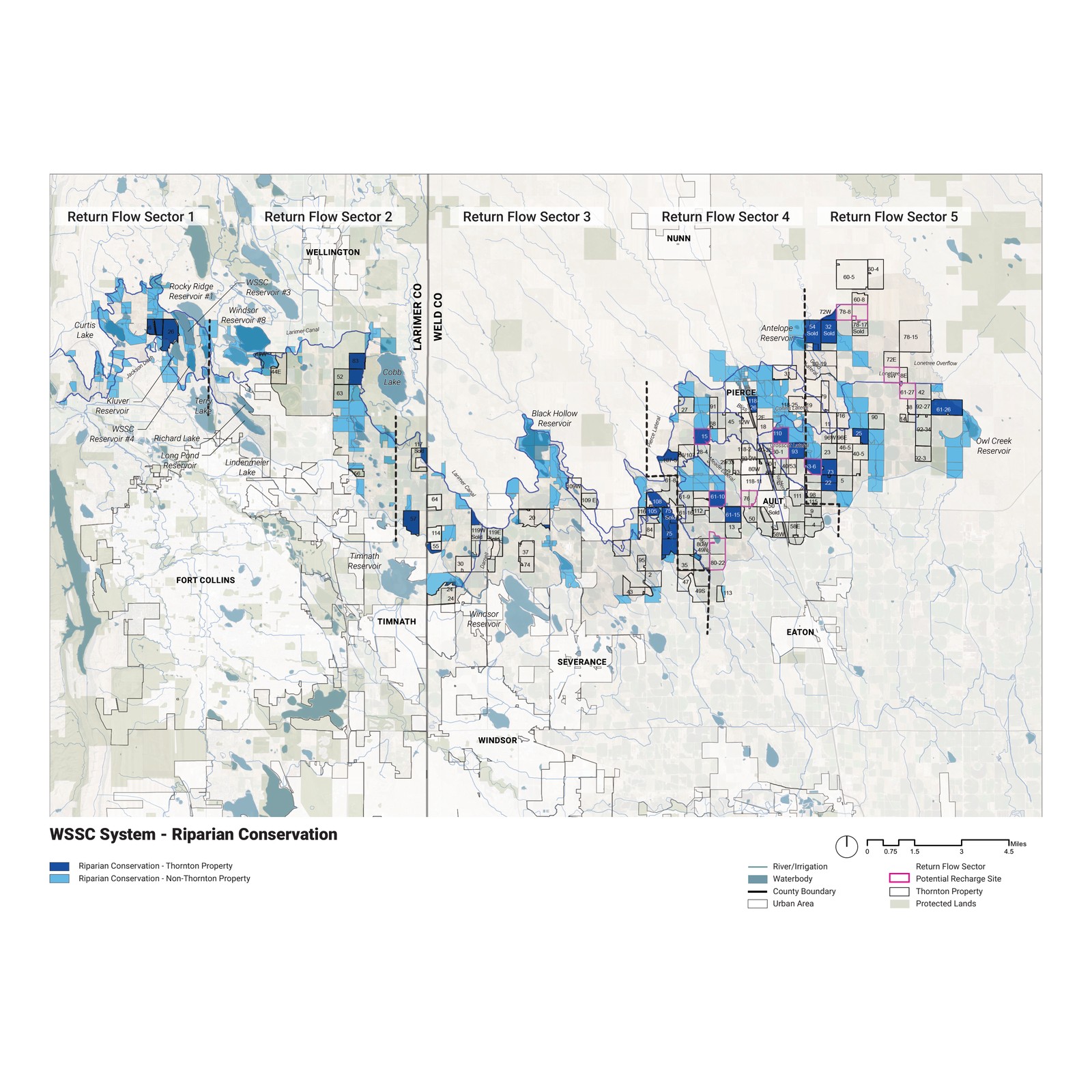
- Conservation — upland and riparian conservation value, protected-lands ownership from COMaP, and a conservation-priority composite weighting biodiversity and landscape integrity.
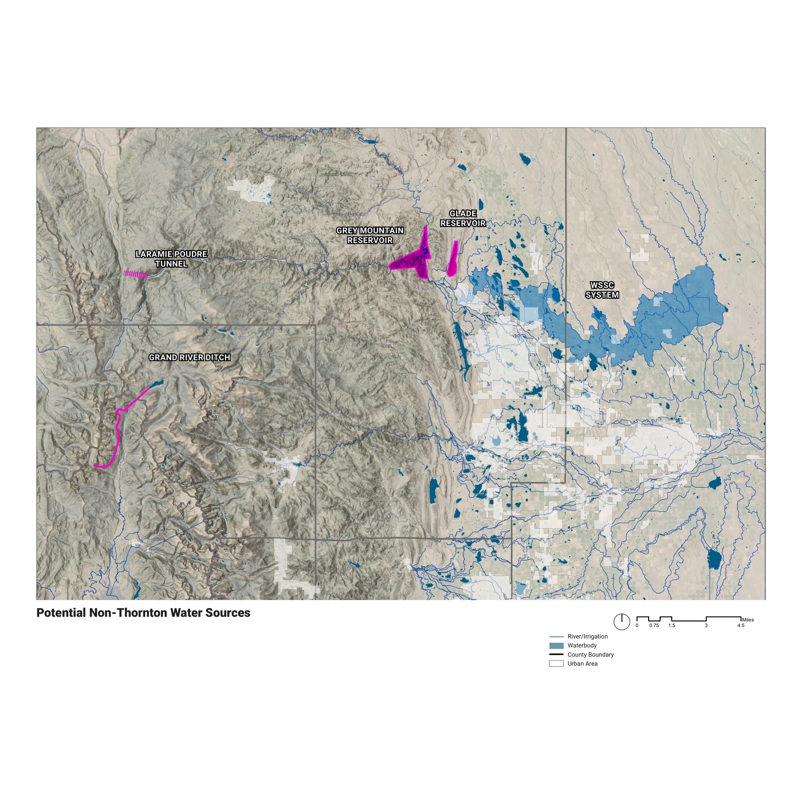
- Regional context — urban growth pressure, well and dairy infrastructure, and potential non-Thornton water sources, locating the corridor against the region that will inherit it.
- 57% of WSSC-irrigated land — roughly 21,000 acres — is USDA-designated Prime Farmland, and over a quarter of that carries a majority of Class 1 and 2 soils.
- Surface water has been removed from an estimated 12,700 WSSC-irrigated acres since 2001; at larger scales the figure is conservative, likely understating actual dry-up.
- Designated urban Growth Management Areas span 64% of land currently irrigated by WSSC shares — the corridor sits on the northern edge of the region's development front.
- The conservation-priority composite locates where continued irrigation, habitat value, and protected-land networks coincide, separating land worth keeping in agriculture from land better retired.
The decree settles where the water goes; it says nothing about the land left behind. Which acres stay in production, which are dried up, and which are worth protecting once the water is gone are decisions that play out over fifty years. Mapping soils, dry-up, growth, and conservation value in one frame gives Thornton, the two counties, and their communities a common basis for making them.
The plan is published by the City of Thornton: Northern Properties Stewardship Plan.